realizing pan-american pipe dreams via the dalton highway
Dates: August 1, 2022 - August 7, 2022
Distance traveled: 882 mi / 1,419 km
Route: Dawson City, YT > Chicken, AK > Tok > Fairbanks > Coldfoot > Deadhorse

Pan-American Highway Plans
“We’re thinking about doing the Pan American…”
“Our hope is to travel from Prudhoe Bay, Alaska to Uishuai, Argentina…”
“Maybe in the next few years…”
We have talked a lot about the idea of traveling the Pan American Highway. This thought has been in the back of our minds for a couple of years now, a constant but indefinite pull, tugging at us and guiding the decisions we’ve made with regards to the rig and the conversations we’ve had with friends and family.
In the past week, this amorphous idea has officially taken shape and become a reality. We have begun our journey on the Pan American Highway, which spans from the Arctic Ocean to the southern tip of South America.

There is still a lot of uncertainty around our PanAm adventure. How long it will take, whether or not we’ll complete it in one continuous shot or break it up, the route we’ll choose–oh, and then there’s this thing called ‘life,’ which sometimes has a tendency of getting in the way of things, and that’s why we always hesitate to make definite plans.
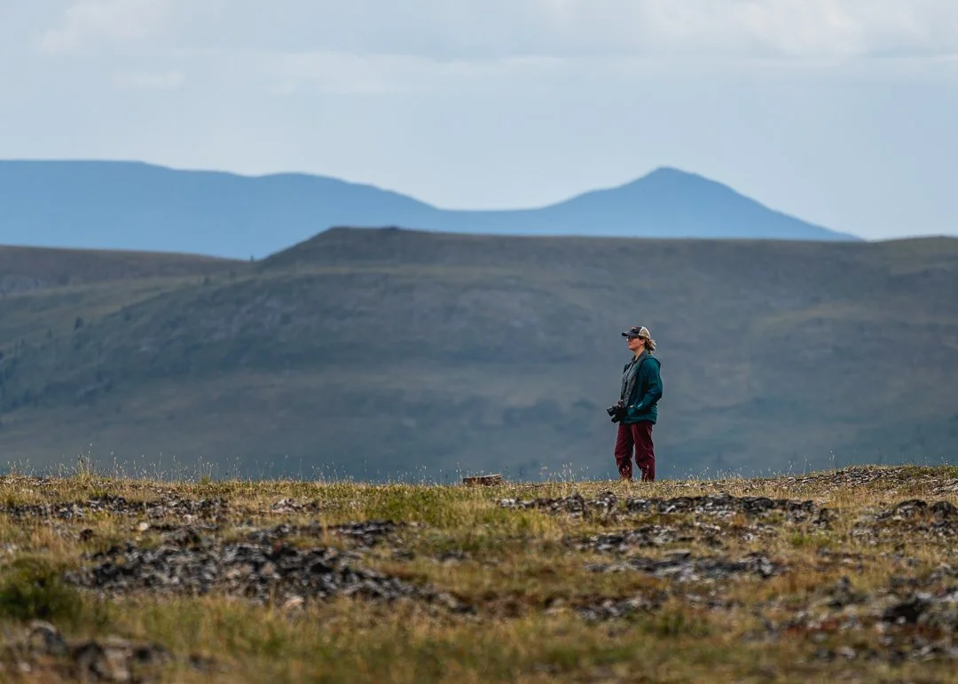
But let’s bring it back to the current journey. Along the way from Dawson City to Prudhoe Bay, Alaska, we drove famously beautiful highways, spotted wildlife, and watched earnestly as the landscape transitioned before our eyes from dense boreal forest to sparse, low-growing fields of arctic tundra.
Top of the World Highway

The streets of Dawson City.
After spending a night in Dawson City and a morning of administrative life-on-the-road things (e.g. forwarding mail, blog writing, etc.), we rolled past the old-timey store fronts on the town’s dirt road and took the small, 24-hour ferry across the river, to the start of the Top of the World Highway.
Note: Formerly known as the Ridge Road, the Top of the World Highway is famous for its high latitude and incredible views along its stretch from West Dawson, Yukon to Chicken, Alaska (or so–the starting point of the highway in Alaska isn’t entirely clear to me).

Up until this point, fuel has been readily available when we’ve needed it. However, that wouldn’t be the case going forward. We happened to realize that we forgot to fill up right after we crossed the river. Not wanting to backtrack and deal with the hassle of crossing the river on the ferry two more times, we did some quick calculations.
It was 106 miles to Chicken, Alaska where we thought there should be gas, and 183 miles until Tok, which we knew would definitely have gas. Our estimated range, after driving relatively flat roads very conservatively, was 232 miles. Even with the expected reduction in range through the hilly roads ahead, we figured the worst case scenario would be running out of gas close enough to Tok to run into town for gas on the motorcycle.

As we made our initial climb up and up and up, our gas range immediately dropped to 150 miles. Despite our concerns about our fuel situation, we were awestruck by the views that unfolded all around us. With clear visibility, the layers and layers of hills and mountains outstretched for miles. At one point, I was able to count at least ten layers of ridge lines.
Like with most of the places we visit, the photos don’t do it justice. The vastness of it all is lost in the snapshots, despite my relentless efforts from the passenger seat to capture it the best I could while Mike focused on oncoming traffic, blind corners, slippery gravel, and our waning fuel supply.

Spot the rainbow!
We found camp along this stretch of road on a hilltop where spent our evening outside, enjoying these moments of ours on “top of the world.”


In stark contrast to the day before, we woke up in a cloud with maybe 50 feet of visibility, a very dangerous situation on this particular road. With a deeper appreciation for the views of the day before, we cautiously began our drive towards the Alaskan border. Relief swept over us as we dipped to lower elevation, beneath the blanket of thick fog overhead.

Waiting in line at the Alaskan border.

Clear visibility and a nice paved road as soon as we entered Alaska.
Thanks to some heavy coasting on the downhill portions of the drive, we arrived in Chicken, Alaska with 87 miles to spare. And they did in fact have a couple of gas pumps.
Fairbanks
Life on the road isn’t all beautiful vistas and butterflies. Sometimes it’s a gravel campsite in a city park with good cell service and a couple of days to regroup and get your lives in order.
Showers at Planet Fitness, grocery shopping, full rig cleaning and re-organizing, laundry, picking up packages and mail, restocking on pet food, dropping off donation items (always looking to pare down what we’re carrying), and catching up on our content creation and social media things kept us busy for two days in Fairbanks.
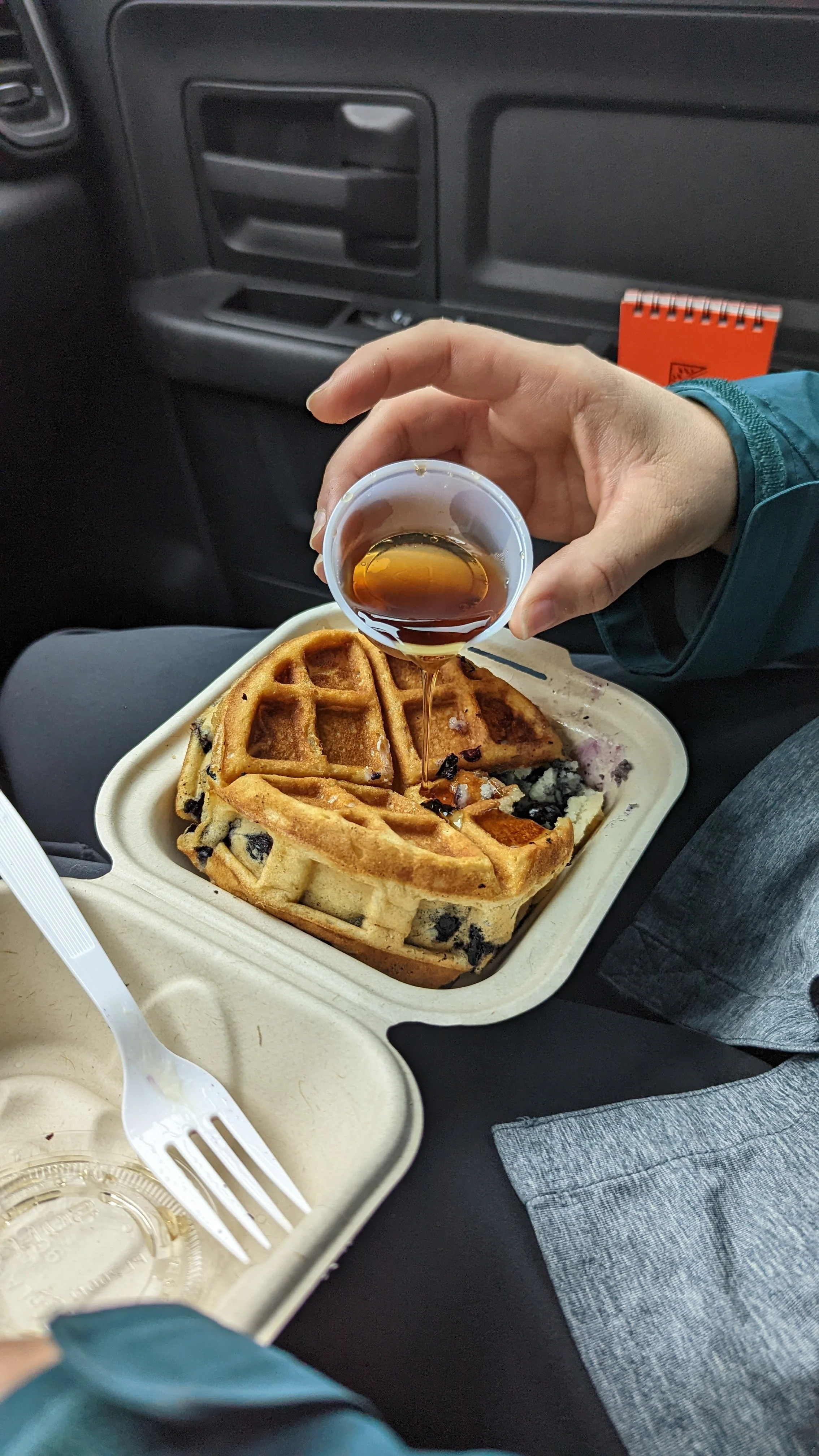
In the midst of all the “work” we also enjoyed exploring a bit of Fairbanks. Lunch at Just the Tips - Boreal Infusion Eatery (absolutely delicious and nutritious), a bike ride to HooDoo Brewing Company (cool spot but was very crowded), and our favorite and a must-do if you visit Fairbanks–breakfast at the Blue Box Bakery.
Note: The owners of Blue Box Bakery are delightful and told us how they are one of the few businesses that stays open, in their little trailer, throughout the long, harsh winters. They’ll use a hairdryer to keep their feet as warm as possible on the cold floor and to melt the ice that inevitably forms on the window where they take and serve orders.


The Dalton Highway
Heading north out of Fairbanks on a rainy Friday morning, we traveled 82 miles to the start of the Dalton Highway, also known as the “haul road.”

The Trans-Alaska Pipeline System (TAPS) is one of the largest pipeline systems in the world. It spans Alaska from north to south and runs parallel to the Dalton Highway and is often in sight from the road. Regardless of its environmental impact, which I am no expert on, it is an astounding feat of engineering to have built something so expansive with the ability to endure extremely harsh and dramatically-changing weather. Learn more here.
Built in 1974 to facilitate the construction of the Trans-Alaska Pipeline, the James W. Dalton Highway is a 414-mile stretch of gravel, dirt, and spots of ruggedly-paved road. Mostly used by truckers carrying supplies to the oil fields in Deadhorse, travelers like ourselves, and hunters, it’s a sparsely driven route with very minimal services. It’s the only road that reaches the Arctic Circle and beyond in Alaska as it winds you through incredibly remote terrain.


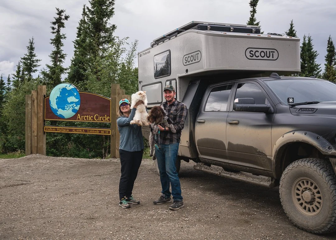
Family photo as we entered the Arctic Circle, the northernmost region of the Earth.
After a long, nine hour day of driving (including stops), we arrived at the halfway point on the Dalton Highway, a tiny “town” called Coldfoot. Coldfoot serves as the fartherst north truck stop in the United States and is one of two places where you can fill up on fuel before reaching the town of Deadhorse. After learning a thing or two at the Arctic Interagency Visitor Center, we filled up on gas for $7.35 per gallon and found camp nearby.
Note: According to travelalaska.com, “it is said that Coldfoot got its name in 1900, when gold seekers made it that far, got cold feet, and turned around.”

Driving north from Coldfoot.
Seventy-one miles north of Coldfoot lies the 4,739’ Antigun Pass of the Brooks Range. It’s the highest pass in Alaksa that is maintained year-round and oftentimes poses a daunting threat to truckers in the winter months, as you may have seen in the popular TV series, Ice Road Truckers.
With an impending forecast of 2-8 inches of snow on the pass on Saturday night, we didn’t waste any time to clear it before the weather hit. With only a rainy, snowy mix as we crested the pass, we made it through with no issues.

The landscape of the Brooks Range of mountains, which covers about one fifth of the entire state of Alaska, was stunning and gave us strong Iceland vibes.
To our delight, we awoke on Sunday morning to a fresh, thin blanket of snow on the surrounding mountains, making for an even more spectacular drive for the remainder of the Dalton Highway, on our way to Deadhorse.


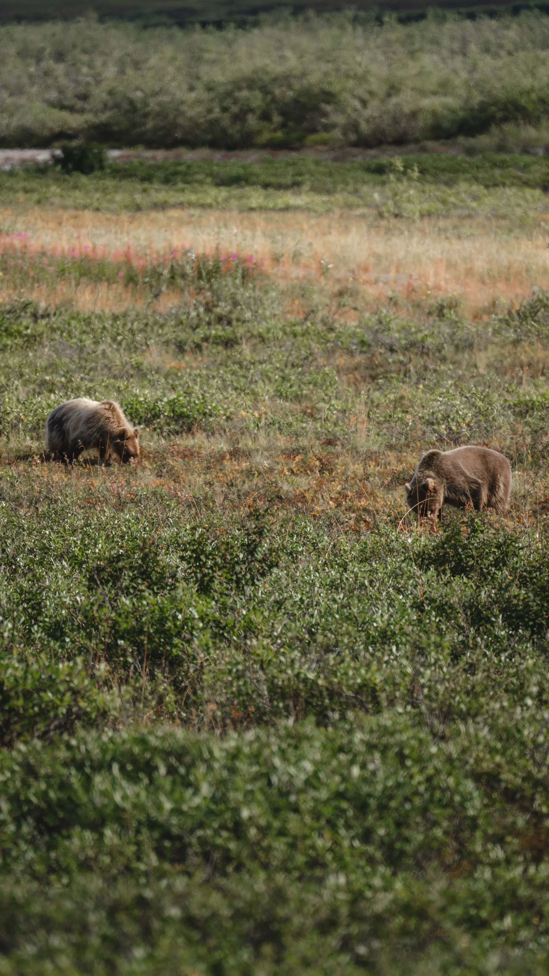
In addition to our usual companion along this drive, the oil pipeline, we were also briefly joined on this day by a number of furry friends. Caribou were plentiful, but we had to look harder to spot a couple grizzly bears, a musk ox, and a sly red fox.


The Arctic Ocean
It’s not possible for travelers to drive all the way to the Arctic Ocean in Prudhoe Bay due to the area being an active oil field. Many folks drive as far as they can, until they reach a security block, and then simply turn around without ever seeing the Arctic Ocean. This felt too anticlimactic for us, so we booked tickets for a shuttle ($69 each), which takes you from Deadhorse Camp to the water on a thirty minute, informative ride.
Note: From travelalaska.com: “Located at the northernmost reaches of the Alaska road system, Deadhorse and Prudhoe Bay sit on the coast of the Arctic Ocean at the heart of Alaska’s oil patch. Deadhorse is more of a work camp than a town in the traditional sense, located in the Prudhoe Bay area. It was established to support oil development in the surrounding area. Most buildings are modular, pre-fabricated types, situated on gravel pads on tundra bog. Virtually all the businesses are engaged in oil field or pipeline support such as drilling, construction, and maintenance. In the summer, the midnight sun doesn’t set for almost 64 days, with constant daylight from May 20 to July 22, while in winter the area gets 55 days of darkness, from November 24 to January 18.
Squeezed into the last row of seats in the 15-passenger van, a fellow two year-old rider from a few rows up turned to us and asked “are you ready?!” We responded in the affirmative but were getting more nervous by the minute. We had told several people we planned to do an arctic plunge in the water on this outing, but as we neared the bay, we wondered if we might regret having made such an announcement. There was still time to chicken out, and not jumping into frigid cold water is always more appealing than the alternative.
Once the van parked at the end of the East Dock Rd., our unofficial tour guide, the two-year old, announced “let’s go everybody!” We complied.

Though we were underwhelmed by the sight of the Arctic Ocean, we were excited to have made it there nonetheless.
The view was uninspiring–a pebble beach, murky brownish water, and unimpressive waves, if you could call them that. The wind was whipping and chilled our fully clothed bodies. We set up the camera on the tripod, gave eachother a look that said “I guess we’re doing this,” and began to disrobe until we reached the swimsuit layer.
Emboldened simply by the audacious act of wearing nothing but a swimsuit in such undesirable conditions, we waded into the water until the smooth rocks beneath our feet turned to mushy ickiness. Stepping back onto the solid ground, I lowered my body into the water up to my shoulders, and Mike quickly followed–and then just as quickly evacuated back to the shore in order to take my photo, or so he claims.

I typically keep my hands out of the water when doing cold plunges because they have a tendency to change color to purple or white if submerged, and that can be alarming.
On this Long Covid health journey of mine and upon the guidance of my health coaches, I’ve been experimenting with cold water exposure therapy. Intentionally putting your body into a an intensely stressful situation (like 33.8°F water) while remaining calm and controlling your breath can help to retrain your nervous system on how to respond appropriately to stressors. With this purpose in mind, I stayed in the water for a full minute before retreating.
After the shock of the cold water, we sat together comfortably on the rocky beach, no longer phased by the windchill, and soaked in the moment (pun intended); we swam in the Arctic Oean; we traveled the entirety of the Dalton Highway; and we finally reached the starting line of the Pan American Highway.
